Monday, March 30, 2020

Cotopaxi National Park


Vulcan Cotopaxi, at 19,347ft is the second tallest volcano in Ecuador. It last erupted in 2015 and the park remained closed to climbers for two years. It was first summited in 1872 and is now climbed by an estimated 5,000 people each year. It takes two days to traverse the glaciers and reach the summit.
The first thing you notice upon entering Cotopaxi National Park are the densely packed pine trees lining the road. As you continue they become much taller and thinner until you reach paramo- the area above the treeline and below the permanent snowfield.


We continued on to the highest point you can reach by vehicle, the climber's trailhead at 4800m (15,748ft.) You can see from the photos, we had a sunny, clear day, but as the car climbed higher and higher to the parking area, visibility dropped drastically. We had planned to hike to the Refugio, but as soon as we stepped out of the truck, ice falling from the sky began pelting us in the face and body. With stinging faces, we ducked back into the car and decided to just head back down the volcano to check into our room.


Tambopaxi is the only option for lodging or food inside the park. It's nestled in a spectacular location with beautiful views all around. The restaurant has two full walls of windows with a lounge for guests to enjoy the view. Above the restaurant are large hostel-style rooms one for males and another for females.

Our room was located in a second building which comprises six private suites. We had access to a private two-story lounge with floor to ceiling glass walls for gazing at Cotopaxi. 


Above is the lounge, below the view from our room.

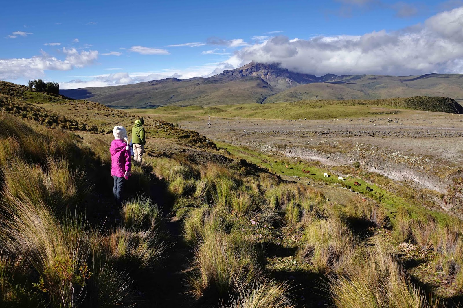
After lunch, we set out for a hike to explore the area.


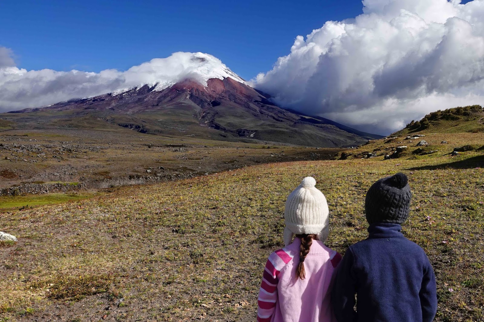
Closeup of the glaciers and fresh snow on Cotopaxi. Often the visibility is low here and people come but never get to actually see the volcano. For this reason we stayed three days in the hopes that we'd see it one of those days. We were super lucky to have a beautiful, clear views of it.


While eating lunch, we noticed a group of cowboys moving cattle across the land. 


I noticed a couple with long camera lenses focused on ponds, so I went to introduce myself to these fellow birders. Jogen and Ann-Christine are visiting from Sweden and had just finished taking in all the magnificent sights of the Galapagos islands. At dinner they shared stories of being an arm's length from sea lions, flamingos and boobies (the blue-footed kind). We ended up spending quite a few meals together and really enjoyed their company. They even taught us some Swedish- Hej! And we all got to enjoy watching Andean Condors together once Asher pointed them out!

The Andean Condor is one of the largest birds in the world! These birds stand 4 feet tall, have a wingspan of 10 feet and can weigh as much as 33 pounds! They need the strong winds over the Andes mountains to keep them in the air. They reproduce slowly, having only one baby every other year.

Jorgen noticed a striking Carunculated Caracara (below) fly to its nest on a cliff, 
so we were able to watch two of them interact in the nest for quite some time.


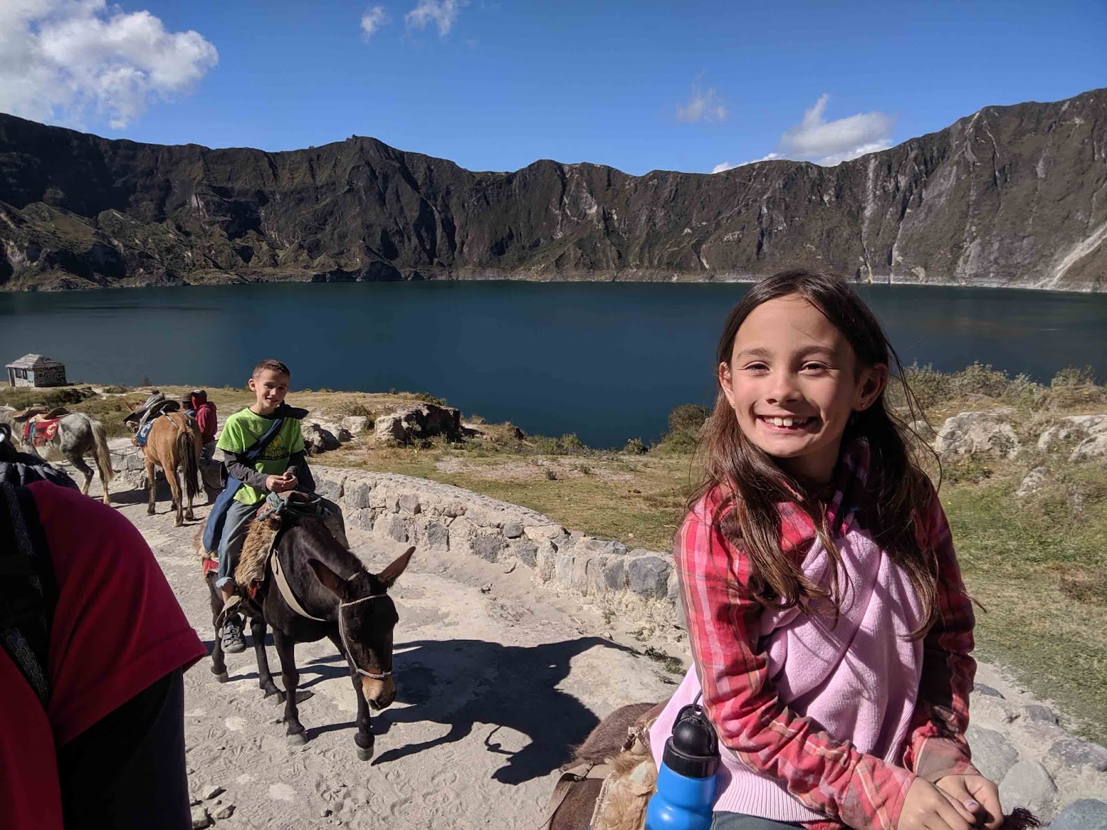
Our last day we spent two hours on horseback exploring thru this beautiful terrain and it was amazing! Our guide pointed out four different volcanos, some comical shaped and some rugged. The trail took us thru shallow rivers and past the remnants of a less fortunate horse.


Goodbye Cotopaxi! Thanks for the memories!

Saturday, March 28, 2020

Laguna Quilotoa


From Shell we took the bus to Latancunga and then a taxi to Quilotoa. The 3 hour bus ride gave us time to watch the entire live-action version of Tarzan. We were relieved at the movie choice as our Ecuadorian bus experiences in the past have included very inappropriate movies (strippers and graphic gun violence).


We paid $20 for a beautiful 2 hour drive from Latancunga to Quilotoa. Shades of green and brown patchwork quilt terrain stretched over hills, mountains and valleys, is really a sight to behold. Though if you are prone to car sickness, prepare yourself as the only road in is super windy and involves passing slower vehicles on narrow roads. In hindsight we should have noticed the racing sticker on our driver's windshield, but I didn't until the wheels were squealing as heaped through the curves. Now imagine you have PTSD from a vehicle accident that occurred along a curve! Whew, I don't know how Daddy made it thru that drive.


Upon our arrival in Quilotoa, I was ecstatic to find our hostel was directly across the street from the Laguna Quilotoa observation deck. We checked into our room and immediately went to see the reason we came.

It was awe-inspiring to look out over this crater which was formed over 600 years ago by a massive volcanic eruption. The turquoise lake is 2 miles wide and 820ft deep and though hot springs contribute the water, it is ice cold thanks to the 12,000ft elevation.


The woman below is wearing traditional clothing of the highland Quechua, 
an indigenous people group that lives in the area. Her hat indicates she is married.

After a few minutes the beauty of the crater was no match for the cold weather and blustery wind. I had lost my husband and children to the warm game room and hammocks in our hostel. I stayed and watched the sunset turn thick clouds pink.


Back at Hostal Chukirawa, Daddy had begun teaching the kids to play chess. They picked it up super fast. Afterwards we settled into our room as it warmed with our own wood-burning stove.


The next day we hiked the steep switchback trail down to the lake. It was not an easy hike, the combination of the elevation (less oxygen), steepness and loose dirt trail lead to many falls for our children and quite a few adults that we passed as well. The wind would often whip up the dirt requiring you to stop and face the opposite direction for a bit. Out of concern for my camera, I tied the arms of my rain jacket around my neck to use as a cover.


We spent a few hours at the lake. Renting a kayak was an option, but I chose to look for birds instead, while Asher played at the water's edge. Camping is available at the lake level, but you must pack everything in and out.


We chose to take the easy way up by riding horses to the rim for $10 each. We were impressed by not only the horses, but the men and women who accompany the horses up and down the crater. The two men who kept our horses in line kept up with us on foot. They told us they go down and back twice a day! Quite a strenuous job.


For a bigger adventure, there is a 6 mile rim trail and a 19 mile Quilotoa Loop trail that you can hike. It takes 3-4 days and there are hostels along the route for overnight stays and meals. Initially the rim trail sounded like a good idea, but now that I've experienced the strong, cold winds along the rim and seen the narrow trail, I'm not sure that I would enjoy that. Many people get lost on the loop trail, so if you are thinking of attempting it, I suggest doing a lot of research during the planning stage.

Next stop Cotopaxi National Park.